Southampton cycle maps
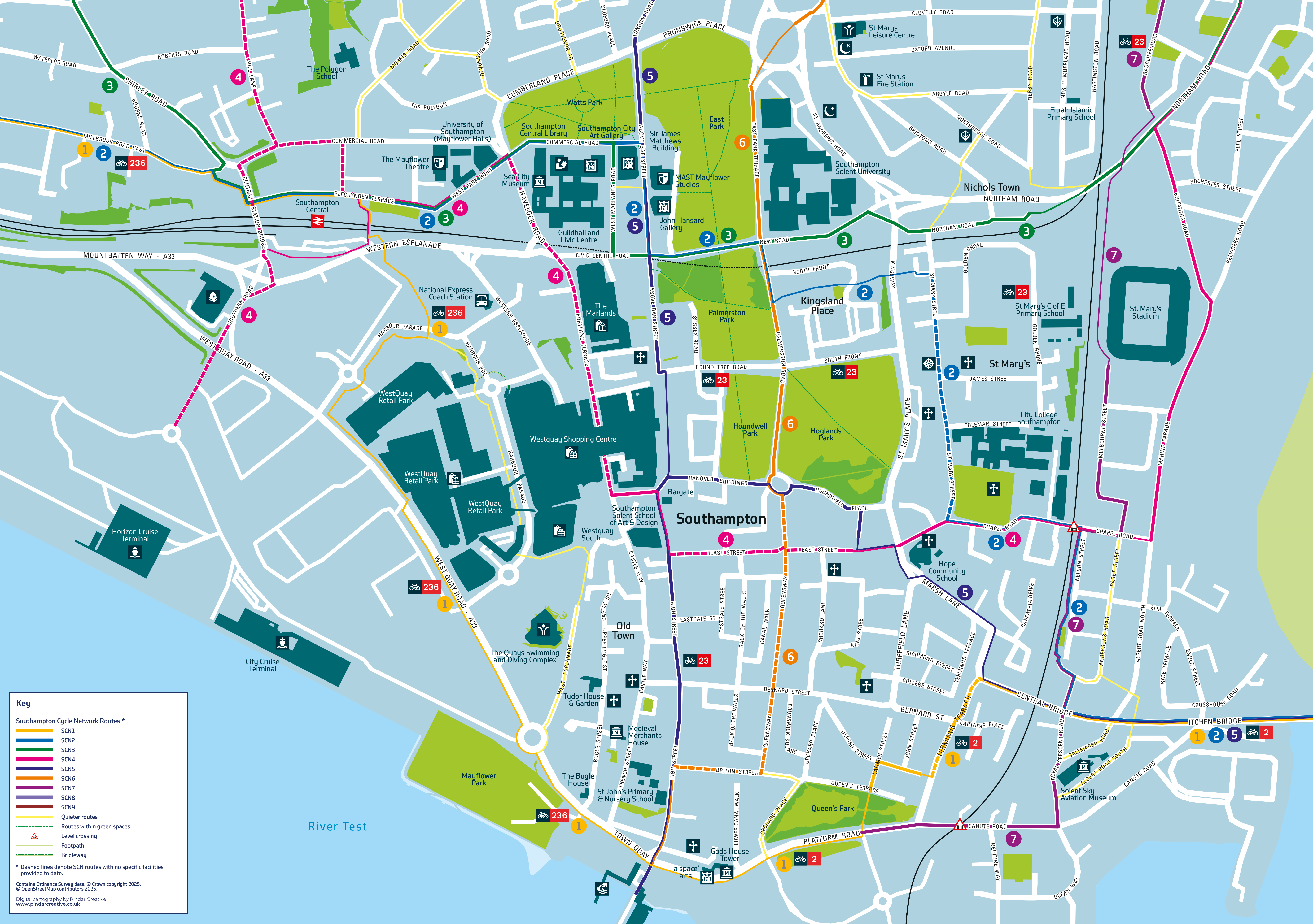

Key
Southampton Cycle Network Routes*
- SCN1
- SCN2
- SCN3
- SCN4
- SCN5
- SCN6
- SCN7
- SCN8
- SCN9
- Continuation of SCN routes into the city centre
- Quieter routes
- Routes within green spaces
- Level crossing
- Footpath
- Bridleway
* Dashed lines denote SCN routes with no spsecific facilities provided to date*
Discover Southampton with the Southampton Cycling Map — your ultimate guide to cycling around the city!
The map shows our Southampton Cycling Network and other cycle-friendly routes, including quieter routes, scenic paths, and key connections to parks, schools, and transport hubs. Plan your journey with the map and check out the SCN routes with our virtual tours on our cycle routes and videos page.
Whether you're aiming to reduce your carbon footprint, increase physical activity levels, save on travel costs, or just enjoy the fresh air, let the map be your guide. Pick up your free copy at local libraries.
For more information about the Southampton Cycle Network and our Cycling Strategy, visit Southampton Cycle Network - transforming cycling in Southampton.